Route 1: Barruelo de Santullán - Balboa Puente Almuhey - Cistierna
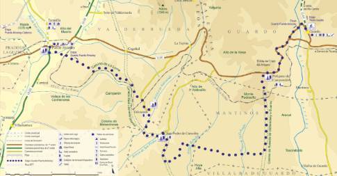
Stage 5 belonging to Route 1: Barruelo de Santullán - Balboa
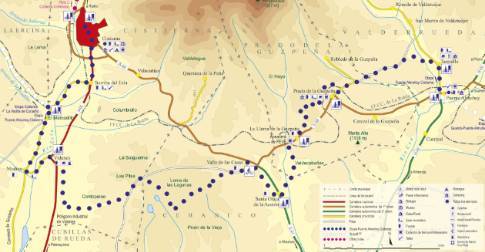
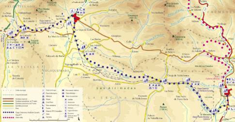
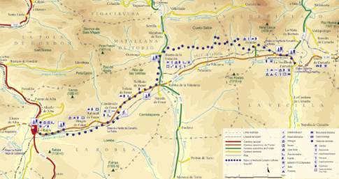
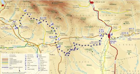
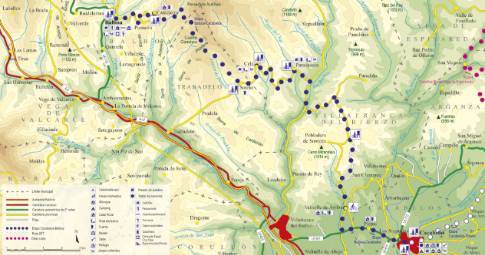
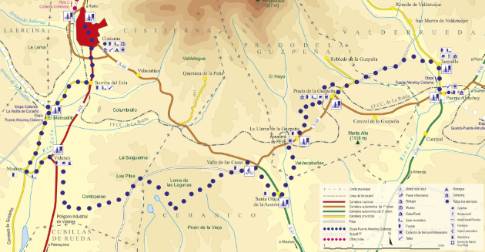
Linear route 31.4 km long and an estimated duration of 3 hours 15 minutes with a gradient of 250 meters. Forest track (60%) and road (40%). Medium-high difficulty. Recommended time: all year round, avoiding rainy seasons.
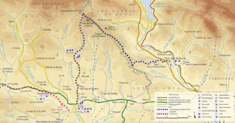
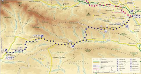
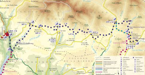
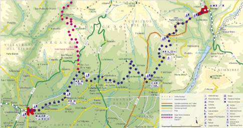
Route map
 High resolution image. This link will open using lightbox, there may be a context switch
Tips and recommendations
After rainy seasons, the tracks in this section can have very muddy steps.
Points of interest
At different points along the route, the route intersects with the La Robla railway, also called "El Hullero", originally created to transport coal to the blast furnaces of Vizcaya.
Near Prado de la Guzpeña is the "Prado chimney", 36 m high, which along with 2 other chimneys and 12 ovens was built in 1960 for the transformation of coal into coke.
Discover it as you pass through {0}
- Taranilla
From Taranilla to Cistierna LENGTH: 30.3 km. DURATION: 3 hours 5 minutes. SLOPE: 250 m. TYPE OF ROAD: forest track (62%) and road (38%). DIFFICULTY OF THE SECTION: medium-high.
- La Llama
From La Llama to Cistierna LENGTH: 22.1 km. DURATION: 2 hours 15 minutes. SLOPE: 230 m. TYPE OF ROAD: forest track (55%) and road (45%).
- Santa Olaja
From Santa Olaja to Cistierna LENGTH: 19.6 km. DURATION: 1 hour 55 minutes. SLOPE: 230 m. TYPE OF ROAD: forest track (52%) and road (48%). DIFFICULTY OF THE SECTION: medium-high.
- Departure from Puente Almuhey
We leave Puente Almuhey along the local road that, crossing the train track, goes up the Tuéjar valley to the town of Taranilla . There, the route deviates to the left along a dirt road that crosses the...
- Departure from Cistierna
Continuing along the Gradefes highway in a southerly direction, the route reaches Modino, where it crosses the Esla to go towards Vidanes. Once there, it surrounds the town's industrial estate along a...
- Vidanes
From Vidanes to Cistierna LENGTH: 7.5 km. DURATION: 30 minutes. SLOPE: 30 m. TYPE OF ROAD: road (100%). DIFFICULTY OF THE SECTION: low. RECOMMENDED TIME: all year round. At the...
- El Mercadillo
From El Mercadillo to Cistierna LENGTH: 3.2 km. DURATION: 15 minutes. SLOPE: 20 m. TYPE OF ROAD: road (100%). DIFFICULTY OF THE SECTION: low. RECOMMENDED TIME: all year round. Continuing...
- Prado de la Guzpeña
From Prado de la Guzpeña to Cistierna LENGTH: 25.5 km. DURATION: 2 hours 35 minutes. SLOPE: 250 m. TYPE OF ROAD: forest track (60%) and road (40%). DIFFICULTY OF THE SECTION: medium-high.
- Valle de las Casas
From Valle de las Casas to Cistierna LENGTH: 17.5 km. DURATION: 1 hour 40 minutes. SLOPE: 230 m. TYPE OF ROAD: forest track (48%) and road (52%).

