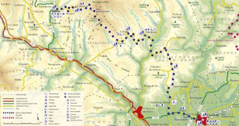
Route 1: Barruelo de Santullán - Balboa La Vecilla de Curueño - La Robla
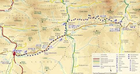
Stage 7 belonging to Route 1: Barruelo de Santullán - Balboa
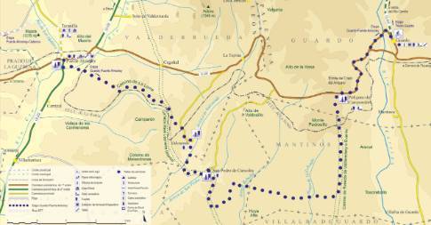
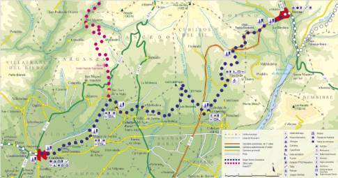
Linear route of 29.6 km in length and an estimated duration of 3 hours 15 minutes with a gradient of 320 meters. Forest track (70%) and road (30%). High difficulty. Recommended time: all year round, avoiding rainy seasons.
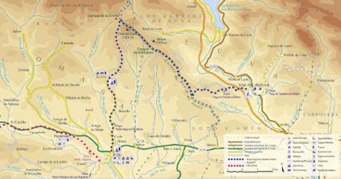
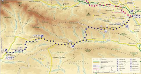
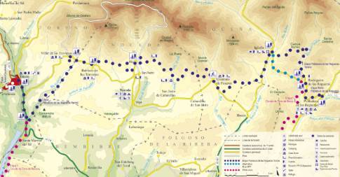
Route map
 High resolution image. This link will open using lightbox, there may be a context switch
Tips and recommendations
The tracks, after rainy seasons, can have very muddy sections.
Throughout the stage, stretches of road are used that require caution and close attention.
Points of interest
In Aviados the ruins of the Guzmanes castle remain, dating from the 14th century.
The La Estación neighborhood of Matallana was born in 1894, when the railway from La Robla to Balmaseda (Vizcaya) was completed. A branch started from this town to the north that connected the Bardaya mine and which has now been converted into a greenway for use by hikers and cyclists. In its vicinity, in the area of Los Mapas, there is an important fossil deposit.
Discover it as you pass through {0}
- Departure from La Vecilla
We leave La Vecilla along the regional highway CL-626 in the direction of La Robla. After a long straight line, the route reaches the center of Campohermoso and turns to the right along an old cart path,...
- Departure from La Robla
We leave La Robla along the regional highway CL-626 in the direction of La Vecilla de Curueño. Just 2.5 km further on you reach the area of La Muria, where the route deviates to the right along the...
- Barrio de la Estación
From Barrio de la Estación to La Robla DURATION: 1 hour 30 minutes. SLOPE: 100 m. TYPE OF ROAD: forest track (65%) and road (35%). DIFFICULTY OF THE SECTION: medium.
- La Muria
From La Muria to La Robla LENGTH: 2.5 km. DURATION: 10 minutes. SLOPE: 30 m. TYPE OF ROAD: road (100%). DIFFICULTY OF THE SECTION: low. In the...
- Robledo de Fenar
From Robledo de Fenar to La Robla LENGTH: 11 km. DURATION: 1 hour 10 minutes. SLOPE: 100 m. TYPE OF ROAD: forest track (65%) and road (35%). DIFFICULTY OF THE SECTION: medium.
- Campohermoso
From Campohermoso to La Robla LENGTH: 27.3 km. DURATION: 3 hours 5 minutes. SLOPE: 320 m. TYPE OF ROAD: forest track (80%) and road (20%). DIFFICULTY OF THE SECTION: high.
- Candanedo
From Candanedo to La Robla LENGTH: 8.8 km. DURATION: 1 hour. SLOPE: 100 m. TYPE OF ROAD: forest track (65%) and road (35%). DIFFICULTY OF THE SECTION: medium.

