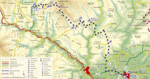
Route 1: Barruelo de Santullán - Balboa - La Losilla
Cistierna - La Vecilla of Curueño
- Previous
- Following
 High resolution image. This link will open using lightbox, there may be a context switch
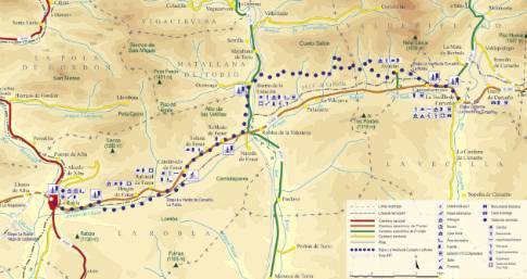
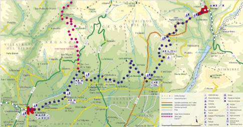
 High resolution image. This link will open using lightbox, there may be a context switch From La Losilla to La Vecilla
- TYPE OF COURSE: linear.
- LENGTH: 13.3 km.
- DURATION: 1 hour 30 minutes.
- SLOPE: 120 m.
- TYPE OF ROAD: forest track (75%) and road (25%).
- DIFFICULTY OF THE SECTION: medium.
- RECOMMENDED TIME: all year round.
At the exit from La Losilla in the direction of Palazuelo de Boñar, take a dirt track that goes off to the right and leads to Boñar. This route crosses from south to north to head to Barrio de las Ollas. From the upper part of this town you come out onto a dirt track that allows us to connect with the Ranedo de Curueño highway. From this road starts a track to the left along which we will descend to Otero and from there, to La Vecilla de Curueño.


