The Way of Saint James from Madrid - Puerto de la Fuenfría
- Route Data
- Ascent slope
- 1796 m.
- Following
Situated in the Guadarrama Mountain Range, it marks the boundary between the Autonomous Community of Madrid and the province of Segovia. It was the site of a Roman road and thoroughfare until 1788 when the Navacerrada Pass was opened. From then on it was practically only used by the Galician labourers on their way to Castilla la Nueva to work on the harvest. Today various stretches of the XXIV branch of the Roman Antonine Itinerary that joined Titulcia and Septimanca (Simancas) can still be seen, as well as remains of the staging post that Phillip II had built here and which was known as Eraso House.
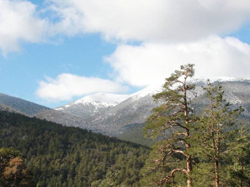
This route leading from the capital city of Madrid to Santiago de Compostela enters Castilla y León via the Fuenfría Pass, a spectacular landscape set amidst pine trees and covered in deep snow in winter. The descent leads travellers into the Castilian lands of Segovia, taking pilgrims towards Valsaín.
What to see?
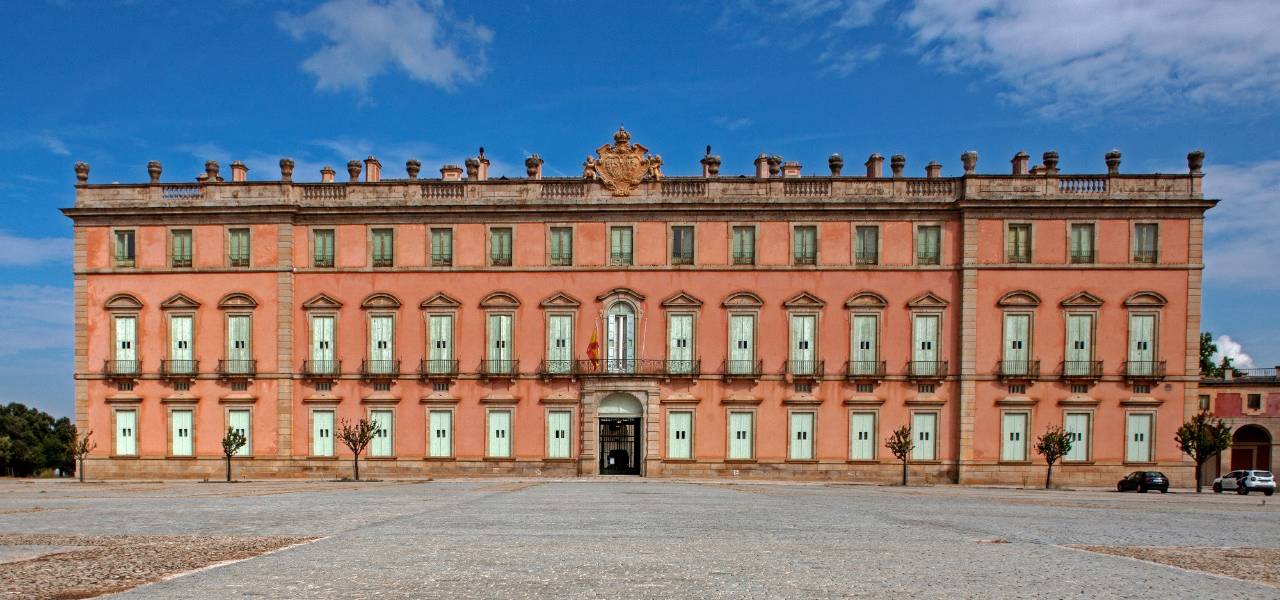 Royal Palace of RiofrioMore information
Palace built in the 18th century, linked to the monarchs and royal palaces since they were built. 15 km from the Palacio de la Granja together forming the royal sites of Segovia.Isabel de Farnesio had...
 Procession of the Holy Burial or Procession of SilenceMore information
The Procession of the Holy Burial, or Procession of Silence, of the Royal Site of San Ildefonso (1751), celebrated on Good Friday, is a religious and popular tradition that has endured through the centuries...
- Classification of Festivities
- Castilla y León Tourist Interest
- Date
- Viernes de Semana Santa
- Town
- San Ildefonso o la Granja
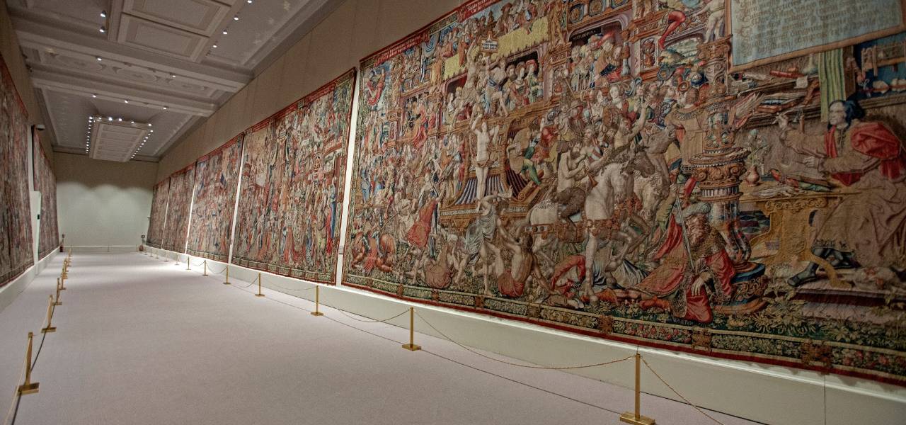
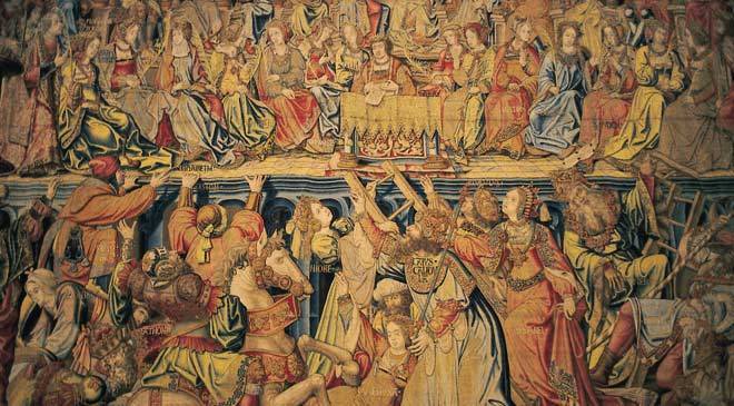 Museum of Tapices of Royal Palace of the Granja de San IldefonsoMore information
Royal residency, an example of European Palentine architecture with gardens and fountains in Versaille style. Richly decorated rooms with Carraca marble.The Flemish series of ‘Los Honores’, the ‘Historia...
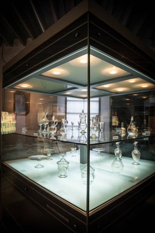 Museum of the Glass. Royal Glass Factory of La GranjaMore information
It is hosted in the former Royal Glass Factory of La Granja, one of the most important industrial buildings in the Europe of the Enlightenment (XVIIIc).Machines, tools, moulds and historical and contemporary...
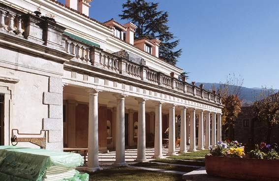 Bauer HouseMore information
It was also known as Casa de Gentiles Hombres until the XIX century. It was built between the year 1774 and 1777, following the plans of the architect Mr. Jose Diaz Gamones, author of other works such...
 Royal Palace of La Granja de San IldefonsoMore information
It was the summer residence of the Bourbons in the 18th and 19th centuries. In 1720 Phillip V bought the land from the friars of the Parral community. The architect Teodoro Ardemans converted the building...
 Royal Factory of Glass of San Ildefonso / Museum of the GlassMore information
This building was erected in 1770 by Carlos III, the walls and the factory are built with granite masonry work and the vaults and domes of brick.The products created here, such as oil lamps, chandeliers,...
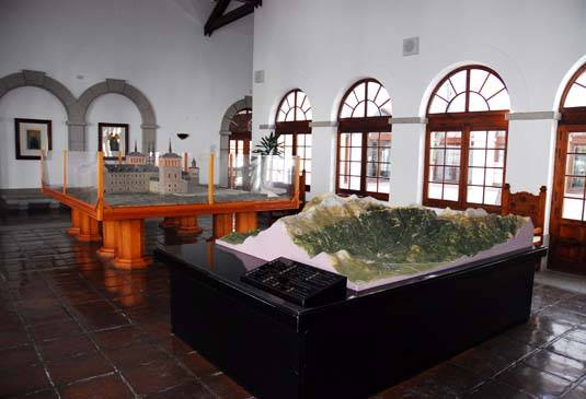 National Center for Environmental Education CENEAMMore information
CENEAM is a reference center in environmental education that has been working since 1987 to promote the responsibility of citizens in relation to the environment. It is established as a resource center...
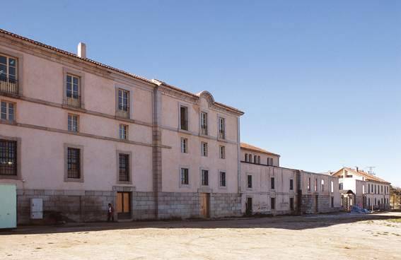
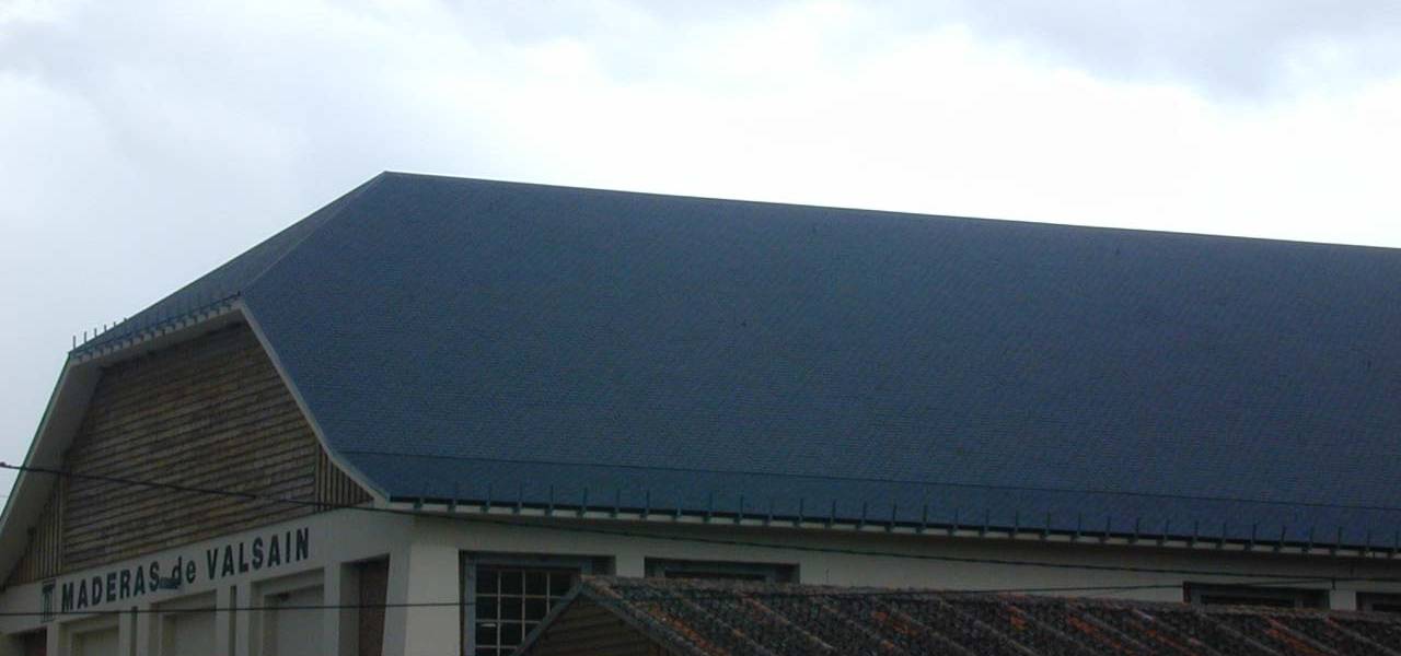 Real Aserrio Mecanico de los Montes de ValsainMore information
At the beginning of the 19th century it was built as a hydraulic sawmill for timber exploitation and at the end of the same century the studies that were the origin of the Royal Mechanical Sawmill of the...