
Approved trails in the province of Valladolid
- Position
- Valladolid
Valladolid is structured by a network of forty-three approved trails, that is, safe and well-marked paths through which reaching any point of interest in the province, on foot or by bicycle, is a suggestive experience. Spring is a good time to let yourself go, but autumn has the magic of the warm light that floods the Castilian fields.
Image gallery
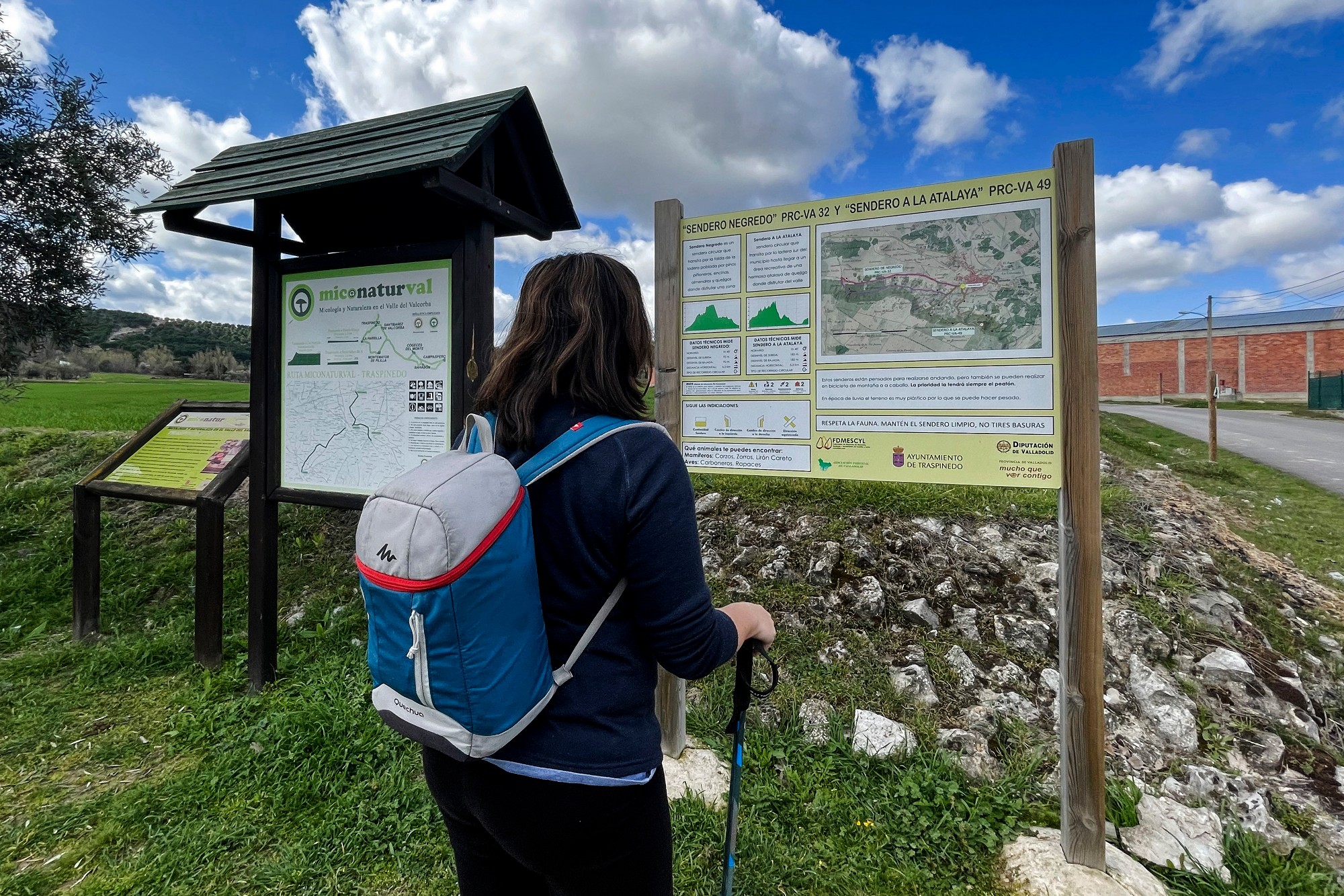
What to see?
 Clarete TrailsMore information
The GR-296 Trail crosses the twelve municipalities that the Cigales Wine Route includes: Cabezón de Pisuerga, Cigales, Corcos, Cubillas de Santa Marta, Dueñas, Fuensaldaña, Mucientes, Quintanilla de Trigueros,...
 V1 - Cañadas Reales (Drovers' road) - Long RouteMore information
Located in the Riberas de Castronuño- Vega de Duero Natural Reserve. With a length of 33 km and a medium difficulty, this long route of the Cañadas Reales (Drovers' road) can be done both on foot and by...
- V2 - Almond Tree PathMore information
Located in the Riberas de Castronuño- Vega de Duero Natural Reserve. This small route, only 3.4 km, begins in the Muela urban park, and runs next to the Duero River. It also has a Bird Observatory: the...
- V3 - Cañadas Reales (Drovers' road) - Short RouteMore information
Located in the Riberas de Castronuño- Vega de Duero Natural Reserve. Like the long route, it starts from Pollos, but with less mileage, 19 km and its beginning is just 8 km from the long route. Its charm...
- V4 - Between Countryside and Wetlands (PRC-VA 28)More information
The route begins and ends in the municipality of Aldeamayor de San Martín and crosses its urbanization, Aldeamayor Golf. On the road that connects the town with the urbanization, there is a small section...
- V5 - Path of the Cut (PRC-VA 8)More information
This route passes through moorland, slopes and valleys, typical landscapes of the Cabezón de Pisuerga area. The approved route, part of the municipality's wineries and a steep slope, takes us to Cerro...
- V6 - Pinilla Pinilla Trail (PRC-VA 31)More information
Among a sea of stone pines, the Mirador de Carramonte shows us the Arenosa Valley and the Transmorisco Peak. The juniper trees lead us along a winding path to see the Pinilla Pine, a beautiful example...
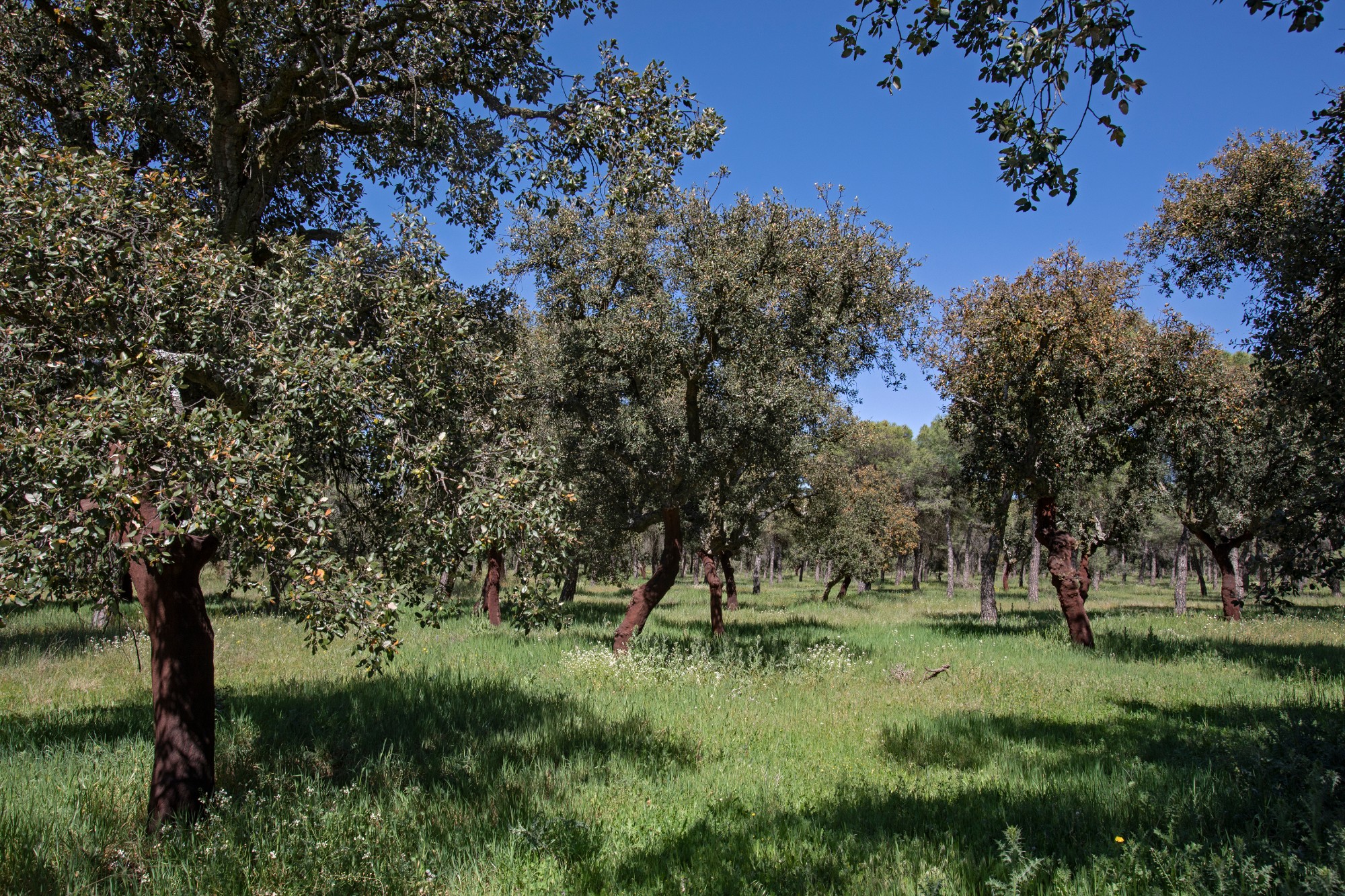
- V7 - El Alcornocal de Foncastín (PRC-VA 36)More information
This circular and flat path runs through the northern area of the municipality of Foncastín, right next to the Zapardiel stream and accompanied by cork oak forests, being one of the most important botanical...
- V8 - Eresma River Trail (PREC-VA 36)More information
With a short route and located in the southern part of the province, this flat path circulates between the Eresma River and the Sangujero stream, in an area of pine trees and river banks, through a forest...