According to the dictionary of the Real Academia de la Lengua, to "be in Las Batuecas" is to be distracted and oblivious to something: meaning, to be engrossed and fascinated. Feelings of this kind are still felt today by the people who visit this secret valley, protected by escarped mountains and containing a beautiful Mediterranean-type forest.
Add to this the valuable cave paintings from the Neolithic era that can be found in the valleys caves and shelters, the high cultural value of the legends of Las Batuecas and the ethnographic and architectural collection of the village of La Alberca, and we find a space without comparison in all of Castilla y León. In the deepest part of the valley is the Carmelite convent of San José. The convent entrance is the starting point of another trail on foot which takes us to the Cascada del Chorro (waterfall) and also enables us to enjoy the scenic beauty of Las Batuecas.
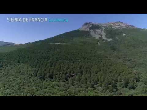
Declared Category: Natural Park (30,187 ha. )
Municipalities in the province of Salamanca: La Alberca, El Cabaco, Cepeda, Herguijuela de la Sierra, Madroñal, El Maíllo, Miranda del Castañar, Mogarraz, Monforte de la Sierra, Monsagro, Nava de Francia, San Martín del Castañar, Serradilla del Arroyo, Sotoserrano, Villanueva del Conde Enviromental Areas Fauna: Wild goat, roe deer, wild boar, and, above all, the Iberian lynx. Black vulture, golden eagle and Egyptian vulture also popular. Relief: Under the protection of the dramatic landscape of the Peña de Francia, there are many deep and isolated valleys with typical flora of the region. Vegetation: True botanic garden with representations of all the species of the Mediterranean world. Route
Accessible Pathway Valle de las Batuecas (PRSA-Senda accesible) Journey: Lineal Length: 1.5 km. Difficulty of the route: Low Show more
Asentadero - Forest of Mirrors Journey: Circular Length: 9.2 km. Difficulty of the route: Low Show more
Camino de los Prodigios Trayecto: Circular Longitud: 10,2 km. Dificultad de la ruta: Media Show more
Cepeda-Herguijuela de la Sierra (PRSA-13) Journey: Lineal Length: 12.6 km. Difficulty of the route: Low Show more
Cycle touring path Río Alagón Length: 16.5 km. Difficulty of the route: Medium-Low Show more
El Cabaco-Nava de Francia-El Casarito-Peña de Francia (PRSA-9) Journey: Lineal Length: 11 km. Difficulty of the route: Medium-High Show more
El Cabaco-Peña de Francia (PRSA-8) Journey: Lineal Length: 8.7 km. Difficulty of the route: Medium Show more
Herguijuela de la Sierra-La Alberca (PRSA-14) Journey: Lineal Length: 8.1 km. Difficulty of the route: Medium Show more
Journey of the Sierra de Francia, by the Laguna de San Marcos (GR-10) Journey: Journey Length: 1.5 km. Difficulty of the route: Low Show more
Journey of the Sierra de Francia, from La Alberca to the Peña de Francia (GR-10 (ETAPA 4)) Journey: Journey Length: 8.7 km. Difficulty of the route: Medium-High Show more
Journey of the Sierra de Francia, from Miranda to Mogarraz (GR-10 (ETAPA 2)) Journey: Journey Length: 5.6 km. Difficulty of the route: Medium Show more
Journey of the Sierra de Francia, from Mogarraz to La Alberca (GR-10 (ETAPA 3)) Journey: Journey Length: 7.6 km. Difficulty of the route: Medium Show more
Journey of the Sierra de Francia, from Monsagro to the recreation area El Vao (GR-10 (ETAPA 5)) Journey: Journey Length: 3.5 km. Difficulty of the route: Medium Show more
Journey of the Sierra de Francia, from Sotoserrano to Miranda (GR-10) Journey: Journey Length: 9.1 km. Difficulty of the route: Medium-High Show more
Journey of the Sierra de Francia, from the Peña de Francia to Monsagro (GR-10 (ETAPA 4)) Journey: Journey Length: 12.5 km. Difficulty of the route: Medium-High Show more
La Alberca - Herguijuela Journey: Journey Length: 8.1 km. Show more
La Alberca-Las Batuecas-Cabras Pintadas (PRSA-10) Journey: Lineal Length: 8 km. Difficulty of the route: High Show more
La Dehesa de Mogarraz (PRCSA-15) Journey: Circular Length: 4 km. Difficulty of the route: Low Show more
Mogarraz-Cepeda (PRSA-12) Journey: Lineal Length: 4.8 km. Difficulty of the route: Low Show more
Monforte de la Sierra-Miranda del Castañar (PRSA-11) Length: 6.3 km. Difficulty of the route: Low Show more
Pathway of the Castaños Centenarios Accessible Pathway (Ruta accesible (para personas con movilidad reducida)) Journey: Circular Length: 1.6 km. Difficulty of the route: Low Show more
Route of the three rivers Journey: Circular Length: 8.4 km. Difficulty of the route: Low Show more
Ruta de las Huellas Fósiles en Monsagro Journey: Circular Length: 1.5 km. Difficulty of the route: Low Show more
SA1 - Camino de las Raíces (Caminos de Arte en la Naturaleza) (SA1) Trayecto: Circular Longitud: 8 km. Dificultad de la ruta: Baja Show more
SA3 - Monforte de la Sierra - Miranda del Castañar (SA3) Trayecto: Lineal Longitud: 6,8 km. Dificultad de la ruta: Baja Show more
SA4 - Senda Accesible "Valle de Batuecas" (SA4) Trayecto: Lineal Longitud: 1,5 km. Dificultad de la ruta: Baja Show more
SA5 - Senda de los Castaños Centenarios "Ruta Accesible" (SA5) Trayecto: Circular Longitud: 1,6 km. Dificultad de la ruta: Baja Show more
Water Way Journey: Circular Length: 6 km. Difficulty of the route: Low Show more
Way Cepeda-Monforte de la Sierra (PRSA-19) Journey: Lineal Length: 4.8 km. Difficulty of the route: Medium-Low Show more
Way Herguijuela - Fuente Mundo (PRSA-18) Journey: Lineal Length: 2 km. Difficulty of the route: Low Show more
Way circular de Madroñal (PRSA-20) Journey: Circular Length: 5 km. Difficulty of the route: Low Show more
Way of las raices Journey: Circular Length: 8 km. Difficulty of the route: Low Show more
Way of los Rodales (PRCSA-16) Journey: Circular Length: 6.5 km. Difficulty of the route: Low Show more
Way of the Peñasco (PRCSA-17) Journey: Circular Length: 2 km. Difficulty of the route: Low Show more